

Project funded by
NSF
as part of the
EarthScope Program
Field instrumentation support provided by
IRIS.

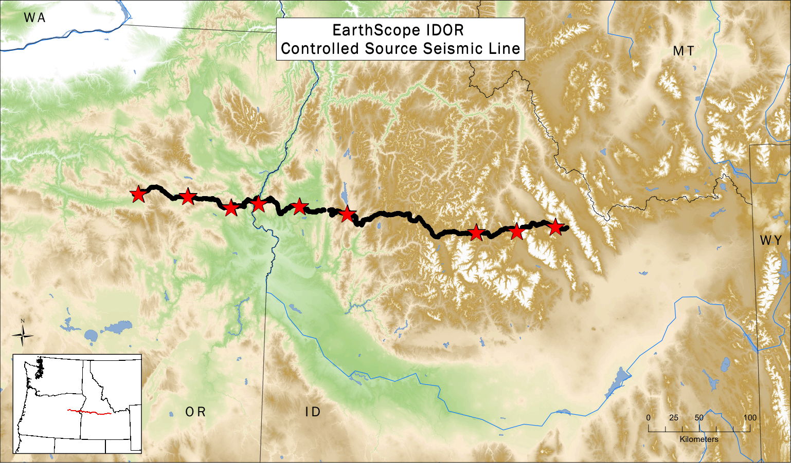
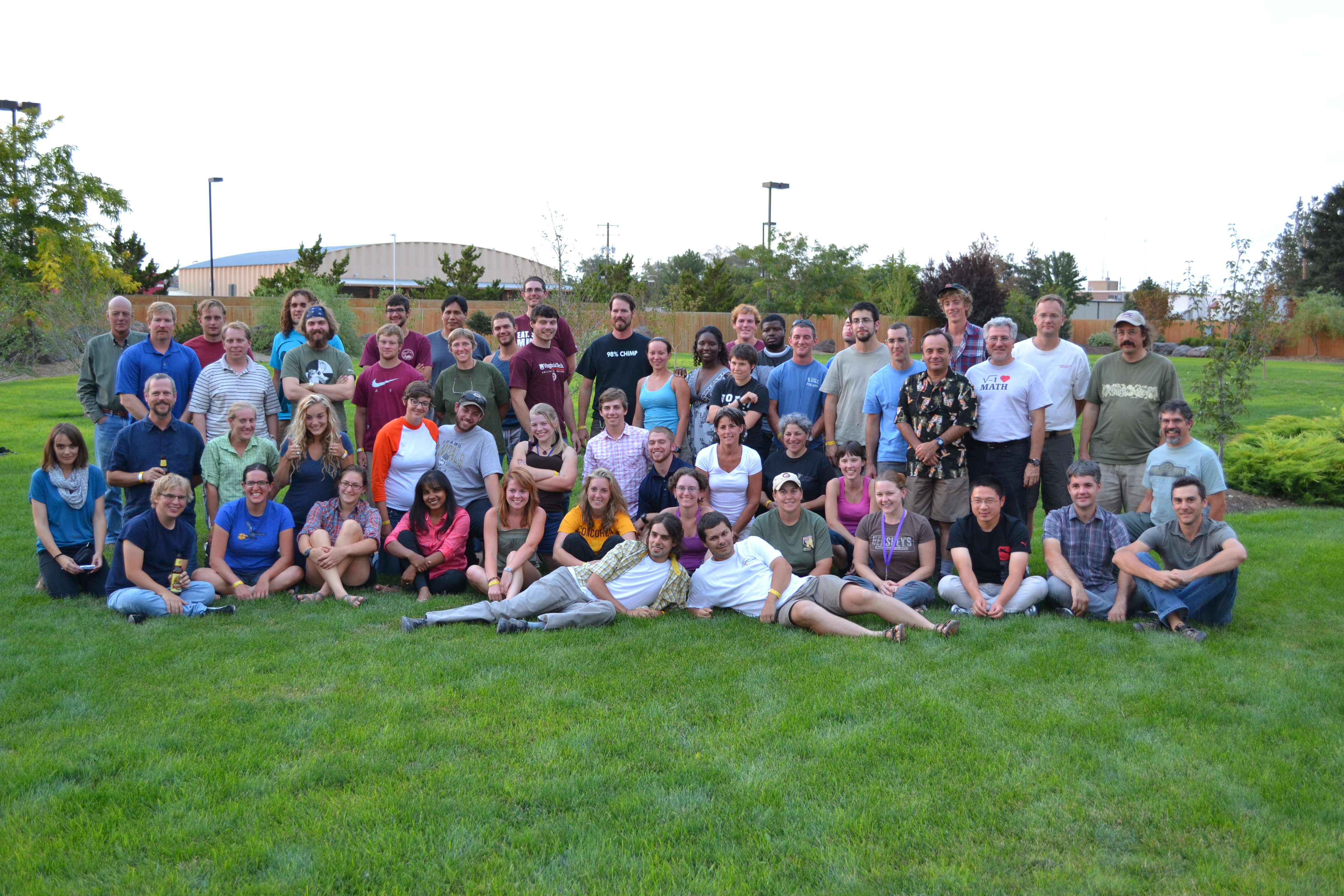
Most of the 61-person controlled-source seismic crew were volunteers, mostly students, from 22 different universities.
A sincere thank-you for all your hard work!
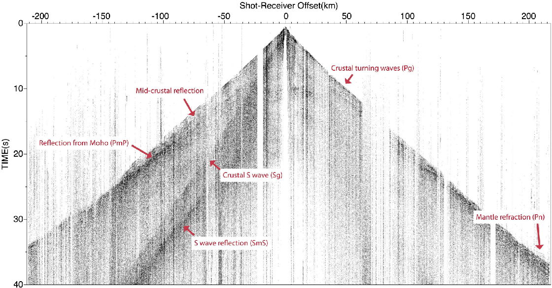
Band-pass filtered data from one shot.
The image shows strong P-wave and S-wave energy that has refracted (turned) in the crust,
energy that has reflected from the mid-crust and the Moho, and energy that has refracted in the uppermost mantle.
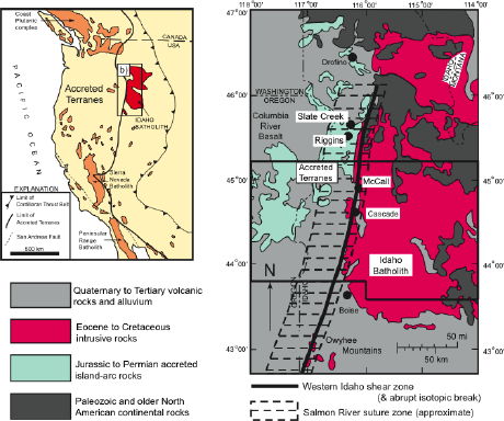
Western Idaho and eastern Oregon exposes a remarkable example of the abrupt juxtaposition of accreted oceanic terranes to the Precambrian North American continent. Although accretion of the oceanic terranes occurred in the Late Jurassic - Early Cretaceous, transpressional shortening in the Late Cretaceous western Idaho shear zone (WISZ) created the present sub-vertical boundary between pre-existing continental lithosphere and accreted oceanic arc lithosphere. Following movement on the WISZ, the margin was affected by intrusion of the Idaho batholith, Sevier thrust faulting, Eocene (Challis) magmatism, Miocene (including Columbia River basalt) magmatism, and Miocene-present ongoing extensional deformation.
Importantly, the study area has been proposed to include an offset vertical, lithospheric-scale boundary - a crustal portion of the western Idaho shear zone is separated from its lower lithosphere continuation - which will allow us to gain fundamental insight into the strength of different lithospheric layers with regard to different types of reactivation.
This proposal integrates seismology, geochemistry/geochronology, and structural geology to investigate three major issues associated with the evolution of this continental margin: 1) how do fundamental lithospheric structures, such as the continental-oceanic lithosphere boundary (WISZ), guide subsequent deformation and magmatism?; 2) how does magmatism and extensional deformation cause modification (destabilization) of the continental lithosphere , and at what lithospheric levels?; and 3) what are the tectonic implications of this destabilization for magmatism, deformation, and evolving lithospheric strength? A swath of broadband passive seismic instruments and a seismic refraction line will delineate the current geometry of the major geologic units and their boundaries at depth. Geochemistry and geochronology will characterize post-WISZ magmatism to provide the timing of events and the tectonic context of the abundant magmatism. Structural geology will provide the kinematic and dynamic deformation path by which the continent was modified, by defining the major tectonic boundaries and establishing the kinematic history of the major structures.
Broader Impacts
The collaborative project provides opportunities for at least 4 graduate and at least 8 undergraduate students from our institutions to interact and to understand the different tools that each of the disciplines brings to bear on a complex problem, and to collaborate in the integration of multi-disciplinary data. We will develop and disseminate teaching materials, demonstrating our integrated tectonic research results, including running a workshop on this topic. Finally, we will pursue separate funding for a series of high-school teacher professional development workshops in Idaho. These workshops will capitalize on teacher interest in a large scientific effort in their state to enhance their ability to teach about geology.
Location map, and generalized geology and tectonic setting.
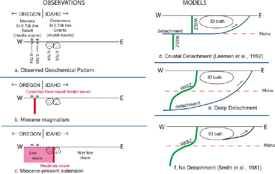
LEFT: Geologic/tectonic observations:
a) two sharp boundaries are observed in the Sr isotopic ratio (0.706 lines), one recorded in Cretaceous granitic rocks (at the WISZ) and the other recorded in Miocene basalts.
b) Miocene basaltic magmatism is localized on the Miocene Sr 0.706 line.
c) Miocene-present extension occurs west of the Cretaceous Sr 0.706 line, and is localized on it.
RIGHT: Simple tectonic models that might explain the two observed Sr isotope lines and Sevier-age thrust deformation to the east.
d) The WISZ was originally vertical through the entire lithosphere and was offset by a Sevier-age detachment (Leeman et al., 1992).
e) The WISZ was created with offset shallow and deep deformation, and was not cut by a deeper detachment.
f) The WISZ was created with offset shallow and deep deformation, and lies far west of any detachment (Smith et al., 1981).

To Basil Tikoff's home page
To John Hole's home page
To Ray Russo's home page
To Jeff Vervoort's home page